Colombian Exchange Day 1
Objective(s):
Given a chromebook with access to Google Docs, students will be able to analyze primary documents of the various groups involved in Columbus' first encounter with the native populations in Western Hemisphere and evaluate the impression each had of each other.
Rationale: Understanding first impressions of groups who had never see or interacted before will provide some valuable insights about an exchange of cultures which is somewhat impossible to replicate in the 21st century
Evidence: Being able to evaluate and analyze first encounters will demonstrate that students understand the isolation the native people of the Western Hemisphere had for all those years.
_________________________________________________________________________________________________________________________
Today's schedule
Columbian Exchange Section
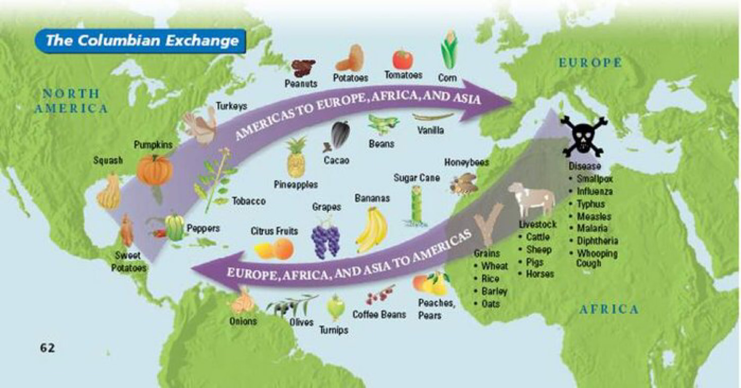
The Columbian Exchange activity will assist in introducing the event to you.
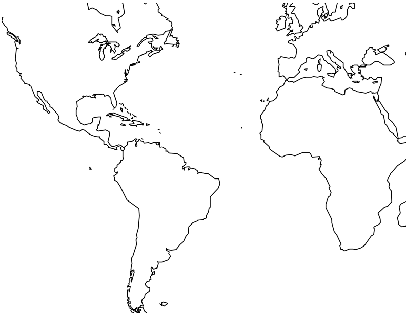
Part 1 - Get the modified world map beneath instructions. Using Google Slides, copy this map onto 3 separate slides. Make a 4th blank slide for answers to questions.
Get the directions to the activity - ( here )
Part 2 - Intro to annotate the Columbian Exchange - ( here )
Part 3 - Columbian Exchange Reading - ( here )
Part 4 - Columbian Exchange DBQ - ( here )
________________________________________________
Mapping Timeline Project - Nov. 1
Timeline Project Timeline Project Directions
Here is a resource that can be used on the timeline project
- Timeline resource
- Navigational Tools Website
- Exploration Museum
Mapping and Explorers
Objective(s):
1. The advantages of coordinating multiple geographic representations—such as maps, globes, graphs, diagrams, aerial and other photographs, remotely sensed images, and geographic visualizations to answer geographic questions
Therefore, the student is able to:
A. Explain the advantages of using multiple geographic representations to answer geographic questions, as exemplified by being able to
Rationale: Understanding how maps were created and used allows students to understand the history of exploration and its impact on imperialism.
Evidence: Being able to articulate who pioneered/paid for the trips of explorers will allow students to list and explain the historical significance of maps.
________________________________________________________________________________
History of Map Making presentation
Presentation - you will have access to a pdf copy of this presentation when it has been presented
Your timeline should contain information from the presentation, the 3 articles about Hist of Map Making and the Navigational Tools Article
Here is a resource that can be used on the timeline project
- Timeline resource
- Navigational Tools Website
- Exploration Museum
Mapping and Explorers
Objective(s):
1. The advantages of coordinating multiple geographic representations—such as maps, globes, graphs, diagrams, aerial and other photographs, remotely sensed images, and geographic visualizations to answer geographic questions
Therefore, the student is able to:
A. Explain the advantages of using multiple geographic representations to answer geographic questions, as exemplified by being able to
- Explain how multiple geographic representations and geospatial technologies (e.g., GIS, GPS, RS, and geographic visualization) could be used to solve geographic problems (e.g., help determine where to locate a new playground, or identify dangerous street intersections within a community).
- Describe how an analysis of urbanization can be done using different geospatial technologies (e.g., RS for land use, GIS data layers to predict areas of high/low growth, GPS and GIS for identifying transportation issues regarding growth).
- Explain how multiple geospatial technologies can be used to solve land-use problems (e.g., effects of new farming technologies on the sustainable production of food, preservation of wetlands in bird migration flyways).
Rationale: Understanding how maps were created and used allows students to understand the history of exploration and its impact on imperialism.
Evidence: Being able to articulate who pioneered/paid for the trips of explorers will allow students to list and explain the historical significance of maps.
________________________________________________________________________________
History of Map Making presentation
Presentation - you will have access to a pdf copy of this presentation when it has been presented
Your timeline should contain information from the presentation, the 3 articles about Hist of Map Making and the Navigational Tools Article
EXPLORERS PROJECT
When learning about early Map Making, it should transition into how were those maps used and or expanded into the maps we know today. For that, we will study early explorers to understand why they ventured out to "discover" new lands and how maps were shaped by these voyages.
An explorer will be assigned to each student.The Explorer you are assigned is the explorer with the same number as your current seat.
i.e student sitting at seat 11 gets explorer #11
The directions for the project are listed below
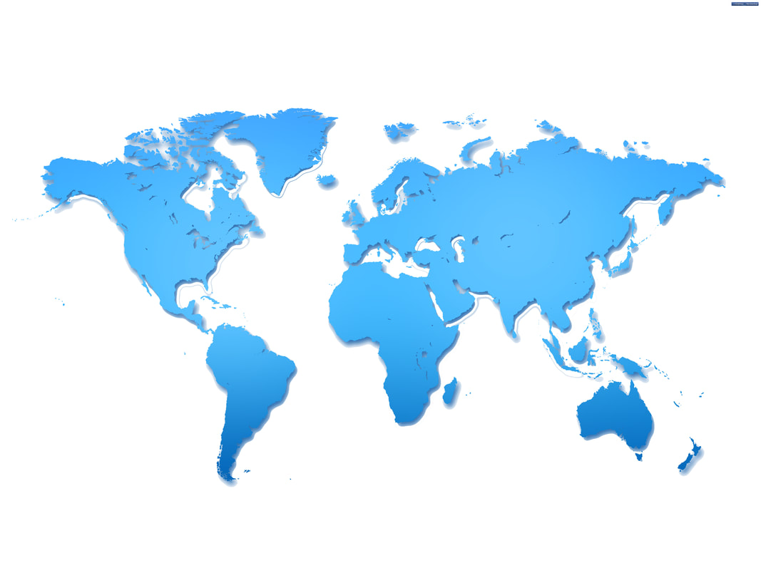
This is the World Map you will use on your Explorers project
This map is very big, and you should crop out the part of the Map where your Explorer took his voyage(s). Use Google Slides to draw the path(s) from where your Explorer started and where he landed. Be sure to use dates and different colors to depict different voyages (if he in fact took more than one voyage)
Explorers Project - Directions Page: ( Link )
Resources for the Project
Explorers Name and links to informational websites: ( Link )
Explorers Information website:( Link )
All about Explorers:( Link )
Notable Explorers: ( Link )
Conquistadors: ( Link )
Mr Donn's Site: (Link)
When you finish with your Explorer Project submit it into Google Classroom Folder.
Then Start
When learning about early Map Making, it should transition into how were those maps used and or expanded into the maps we know today. For that, we will study early explorers to understand why they ventured out to "discover" new lands and how maps were shaped by these voyages.
An explorer will be assigned to each student.The Explorer you are assigned is the explorer with the same number as your current seat.
i.e student sitting at seat 11 gets explorer #11
The directions for the project are listed below
This is the World Map you will use on your Explorers project
This map is very big, and you should crop out the part of the Map where your Explorer took his voyage(s). Use Google Slides to draw the path(s) from where your Explorer started and where he landed. Be sure to use dates and different colors to depict different voyages (if he in fact took more than one voyage)
Explorers Project - Directions Page: ( Link )
Resources for the Project
Explorers Name and links to informational websites: ( Link )
Explorers Information website:( Link )
All about Explorers:( Link )
Notable Explorers: ( Link )
Conquistadors: ( Link )
Mr Donn's Site: (Link)
When you finish with your Explorer Project submit it into Google Classroom Folder.
Then Start